
OsmAnd Offline Travel Maps & Navigation APK 3.4.8
Description
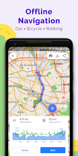
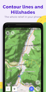
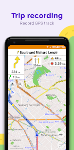
OsmAnd + (OSM Automated Navigation Directions) is a map and navigation application with access to free, global and high-quality data from OpenStreetMap (OSM). Enjoy voice and optical navigation, view POI (points of interest), create and manage GPX tracks, using contour line display and altitude information, a choice between driving, cycling, pedestrian modes, OSM editing and much more. OsmAnd + is the paid application version. By purchasing it, you support the project, finance the development of new functions and receive the latest updates.
Features:
* Works online (fast) or offline (no roaming charges when you are abroad)
* Step by step voice guidance (recorded and synthesized voices)
* Optional lane guide, street name display and estimated arrival time
* Accepts intermediate points in your itinerary
* Automatic route change every time you deviate from the route
* Search for places by address, by type (for example: restaurant, hotel, service station, museum),
* OSM public transport
Supported Android Devices : [4.0.3–4.0.4] Ice Cream Sandwich – [4.1–4.3.1] Jelly Bean – [4.4–4.4.4] KitKat – [5.0–5.0.2] Lollipop – [6.0 – 6.0.1] Marshmallow – [7.0 – 7.1.1] Nougat – [8.0-8.1] Oreo – [9] Pie
Download OsmAnd Offline Travel Maps & Navigation APK 3.4.8 Free Links
Download links
How to install OsmAnd Offline Travel Maps & Navigation APK 3.4.8 APK?
1. Tap the downloaded OsmAnd Offline Travel Maps & Navigation APK 3.4.8 APK file.
2. Touch install.
3. Follow the steps on the screen.
What's new
• New, faster Version 2 (OpenGL) map rendering engine, with 2.5D view
• Smooth animation of location changes while in motion
• New widgets for map center coordinates and elevation of geolocations
• "Distance to tap": added text size options
• "Map marker" widget: added option to change click behavior
• Fixed "Display position" option
• GPX: added support for "link", "cmt", "desc" tags and for any custom extensions
• Reorganized "Nautical maps" list
• Added support for ANT+ sensors
Video
Images


Developer's apps


Most viewed Apps
-
 Download Accelerator Plus Premium APK 2021102120211021 FunAIs JSC
 -
Clone Armies Tactical Army Game mod apk (much money) v7.0.49022.12.17 Elecube
-
Turbo Alarm Alarm clock Pro Mod APK 9.0.79.0.7 Francisco Javier Castaño Gómez
-
Pirates! Showdown Premium mod apk (Unlock all islands) v1.2.4.45Varies with device Flashpoint Games LLC
-
GTA 5 MOD APK 2023 unlimited Money, AMMO + Data
-


