
OsmAnd Offline Travel Maps & Navigation APK 3.5.5
Description
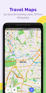
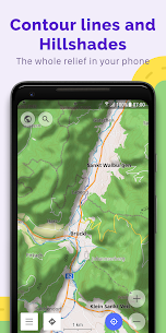
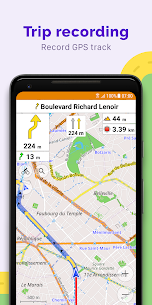
OsmAnd + (OSM Automated Navigation Directions) is a navigation and map application with access to free, high quality, worldwide OpenStreetMap (OSM) data. Enjoy vocal and optical navigation, view POIs (points of interest), create and manage GPX tracks, using the display of contour lines and altitude information, a choice between driving, cycling, pedestrian mode, OSM modification and much more . OsmAnd + is the paid application version. By purchasing it, the project is supported, the development of new features is financed and the latest updates are received.
Features:
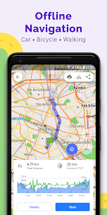
* Step-by-step voice guide (recorded and synthesized voices)
* Optional lane indicator, display of street name and estimated time of arrival
* Support intermediate points on your itinerary
* Automatic rerouting every time it deviates from the route
* Search for places by address, by type (eg: restaurant, hotel, gas station, museum),
* OSM public transport
* View your position and orientation
* Optionally align the image based on the compass or direction of movement
* Save your most important places as favorites
* View POIs (points of interest) around you
Supported Android Devices : [4.0.3–4.0.4] Ice Cream Sandwich – [4.1–4.3.1] Jelly Bean – [4.4–4.4.4] KitKat – [5.0–5.0.2] Lollipop – [6.0 – 6.0.1] Marshmallow – [7.0 – 7.1.1] Nougat – [8.0-8.1] Oreo – [9] Pie
Download OsmAnd Offline Travel Maps & Navigation APK 3.5.5 Free Links
Download links
How to install OsmAnd Offline Travel Maps & Navigation APK 3.5.5 APK?
1. Tap the downloaded OsmAnd Offline Travel Maps & Navigation APK 3.5.5 APK file.
2. Touch install.
3. Follow the steps on the screen.
What's new
• New, faster Version 2 (OpenGL) map rendering engine, with 2.5D view
• Smooth animation of location changes while in motion
• New widgets for map center coordinates and elevation of geolocations
• "Distance to tap": added text size options
• "Map marker" widget: added option to change click behavior
• Fixed "Display position" option
• GPX: added support for "link", "cmt", "desc" tags and for any custom extensions
• Reorganized "Nautical maps" list
• Added support for ANT+ sensors
Video
Images

Developer's apps


Most viewed Apps
-
 Download Accelerator Plus Premium APK 2021102120211021 FunAIs JSC
 -
Clone Armies Tactical Army Game mod apk (much money) v7.0.49022.12.17 Elecube
-
Turbo Alarm Alarm clock Pro Mod APK 9.0.79.0.7 Francisco Javier Castaño Gómez
-
Pirates! Showdown Premium mod apk (Unlock all islands) v1.2.4.45Varies with device Flashpoint Games LLC
-
GTA 5 MOD APK 2023 unlimited Money, AMMO + Data
-


